


Hello, today I am offering you the article “In the footsteps of Vauban” , in order to introduce you to the fortifications and military installations designed by this famous engineer in the Ardennes , and more specifically in the tip of the Ardennes at Givet.
I. Who is Vauban?
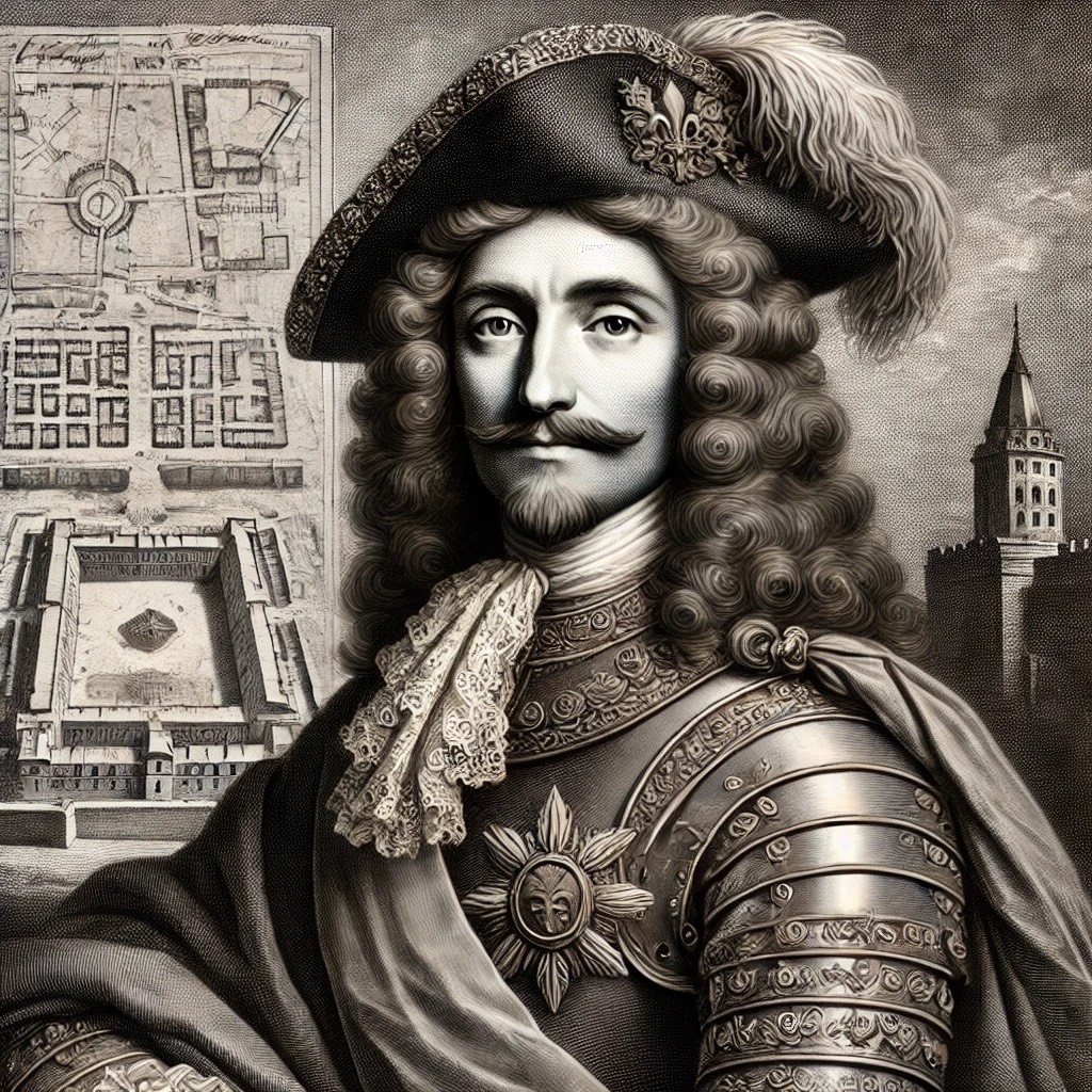
Vauban of his real name, Sébastien Le Prestre de Vauban is nor May, the 1st 1633 in Saint-Léger-de-Foucheret. He is a famous engineer et French military architect. He dedicated his life to protect et reform the Kingdom of France. The effectiveness of its fortifications made him a real right arm of Louis XIV. He was named Marshal of France by the King in 1703.
He designed more than 150 citadels, forts, towns, military and commercial ports and civilian installations under the reign of Louis XIV.
To defend the kingdom and make it invincible against other European powers, he wanted to make France a “square precinct”.
Il dies on March 30 1707 Paris.
"The pré carré is a metaphor used by Vauban to summarize the policy he advised Louis XIV and his ministers to better defend French territory, consisting of rationalizing the defensive system by abandoning isolated strongholds and acquiring others of strategic interest."
But how did Vauban actually implement his strategy for defending French territory at Givet?
II. The legacy and heritage of Vauban in Givet.
Givet is located on the Franco-Belgian border , at the confluence of the Meuse and the Houille , thus controlling river and land traffic between the Netherlands and France.
a) The fortified heritage of Vauban.
After the French conquest of Givet in 1680, Vauban was commissioned by Louis XIV to inspect and improve the existing fortifications . In 1698, he proposed a grand project to complete and improve the place, including the unification of the two boroughs of Givet into a fully fortified town , the construction of an entrenched camp on Mont d'Haurs , and the encirclement of the ends of Charlemont.
The fort or Charlemont:
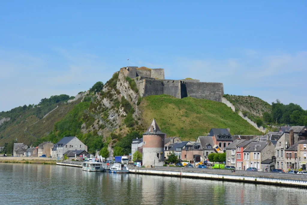
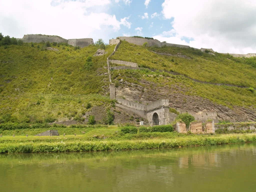
Le Fort Charlemont, or citadel of Charlemont, was built by Charles Quint in 1554. He owns more than ten kilometers of ramparts and has an area of 60 hectares : At the end of the 17th century, even if Givet was naturally preserved thanks to its forests and cliffs, it was necessary to strengthen these defenses. Vauban improved and completed the fort's defenses for the first time from 1678 with a Watchtower and the Fort Conde. He also built at the foot of the fort a 400 meter long barracks and military hospital. The Fort Charlemont will be enlarged a second time in 1697.
The fortified camp of Mont d'Haurs:
Vauban has drawn in 1697 a large camp entrenched on the plateau of Mont d'Haurs to protect the heights overlooking the right bank of Givet. This camp, designed to accommodate 20 men and 000 horses, included a fmain front protected by three bastions reinforced with half-moons. Only ramparts lined with redoubts are installed by Vauban. The construction of the fortified camp began in 1699, but it remains unfinished. The site will then be abandoned in 1706.
Although some of these projects remained unfinished , they demonstrate the extent of Vauban's intervention in the Val d'Ardenne region, extending beyond mere fortifications to include large-scale urban and military developments . The protection of the other fronts was ensured by the sheer cliffs.
Fort Condé (replacing the Maugis tower):
Le Fort Conde was built around a rock which was originally topped with a Watchtower : the Maugis tower, it was also called the tower Villahermosa. This tower was destroyed by Vauban after the annexation of Givet to France in 1678 which was under the possession of the Spanish. Vauban had the central redoubt carved into the rock, it was included in a larger work from 1725 to 1732.
It is located about 500 meters from the Citadel of Charlemont , it had the heavy task of ensuring the defense of the citadel, on the east side and ensuring the defense of the fort of Rome, on the west side.
Today, Fort Condé is listed in the supplementary inventory of historical monuments.
The combination of Fort Charlemont, the fortified camp of Mont d'Haurs and Fort Condé provided a defence in depth, controlling both banks of the Meuse and the surrounding heights.
Saint-Hilaire church on the left bank:
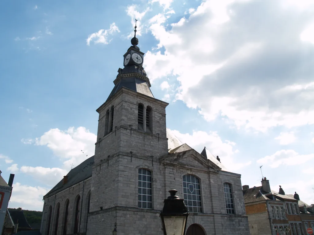
The church Saint-Hilaire was destroyed by Marshal de Créquy in 1675. It was rebuilt under the direction of Vauban from 1682 to 1702.
It is possible that you are unfamiliar with the passage in “Letter V: Givet” from Victor Hugo ’s Voyage Volume I, dating from 1838, in which he mocks the bell tower of the Saint-Hilaire church:
"The brave architect took a square priest's or lawyer's cap. On this square cap, he built an upside-down salad bowl; on the bottom of this salad bowl, which had become a platform, he placed a sugar bowl, on the sugar bowl, a bottle, on the bottle, a sun fitted into the neck by the lower vertical ray; and finally, on the sun, a rooster skewered in the upper vertical ray. Assuming that he took a day to find each of these ideas, he will have rested on the seventh day.
This artist must have been Flemish"
The district and the Notre-Dame church on the right bank:
Notre-Dame Church:
On the right bank of Givet, the church Notre-Dame is located in the district of Notre-Dame.
Heavily damaged after the bombardment of 1675 by the troops of Marshal de Créquy, it was rebuilt in 1686. As a result, the bell tower now towers above the high altar , a rather exceptional feature. The church already existed before Vauban 's arrival ; he incorporated it into his overall plan for fortifications and urban development, which aimed to unite the two banks of the Meuse into a single fortified city.
This church houses a painting of “The Crucifixion of the Lord” , a work by Rubens or Van Dyck.
Furthermore, the Notre-Dame church is located in Place Vauban , highlighting the importance of the military engineer in the development of this area.
The Notre-Dame district:
Vauban has carried out several developments in the Notre-Dame district. in particular by wrapping it in a new fortified enclosure and enlarging it to the Mont d'Haurs plateau. And as part of its second project, the Notre-Dame district has been equipped with barracks and new fortified gates.
The combination of Fort Charlemont , the entrenched camp of Mont d'Haurs and Fort Condé offered a deep defence , controlling both banks of the Meuse and the surrounding heights.
b) The military heritage of Givet.
- The City Towers.
It is important to point out that on the coat of arms of the city of Givet, we find the three Towers of the city: the Victory Tower and the Gregory Tower which are still present in Givet and the Maugis Tower, razed by Vauban who built the Condé fort around this tower.
The Victory Tower:
La Victory Tower, situated at Given, is an ancient three-level cylindrical dungeon dating from the XIV et XNUMXth centuries. Its lower part is built in bricks et blue stones of Givet.
Originally, this tower was part of the lord's residence occupying the southwest corner of the Castrum of Givet Saint-Hilaire . Over time, it has served various purposes: it was a toll tower for boats going down the river, a prison , and after the war, it became a museum.
The origin of its current name dates back to the French period. Previously known as " thour de Givet ", " grosse thour de Givet " or " thourfort ", it was renamed "Tour Victoire" in honor of Louis XIV and his armies, victors of the siege of Namur in 1692.
Today, the Victory Tower is a historical monument , but its interior is only open to the public during Heritage Days.
The Gregory Tower:
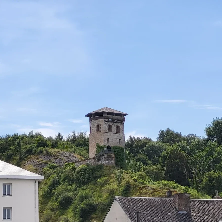
La Gregory Tower is an old Watchtower, it would have been erected at XNUMXth century. Initially, it was called “Saint Gregory Tower”, this in relation to a chapel which was located nearby. It is part of the fortifications of Given, much of which is the work of Vauban. Moreover, he transformed the Gregory Tower as part of his fortification work.
The tower's location allowed control of those approaching Givet. It was therefore a watchtower intended to monitor river , road, and commercial traffic . Occasionally, it also served as a prison.
Even though the interior is not open to the public, the tower offers an exceptional panorama of the town of Givet.
It is important to note that the Victoire Tower and the Grégoire Tower are older buildings that Vauban did not construct. However, he incorporated them into his defensive system and transformed the Grégoire Tower.

- The city gates.
A fortified town under Louis XIV , Givet had six gates , each equipped with a drawbridge and near which stood a guard post housing a soldier on watch. Today, only three remain : the Porte de France , the Porte de Rancennes , and the Porte Charbonnière.
The Rancennes gate:
La Rancennes gate is located near the Rancennes quay. She was part of thefortified enclosure of Mont d'Haurs, built at the end of the Seventeenth century. It was a major element of the defensive system designed by Vauban en 1697. This gate and camp were intended to protect the heights dominating the right bank of Givet.
The gate of France:
La door of France, designed by Vauban, is located on the 8051 route. She is one of the Givet fortifications registered in the monuments en 1991. This door, like the others, was equipped with a drawbridge and guard house sheltering a soldier in charge of lookout.
The Charbonnière Gate:
La Charcoal Door is located at the end of the Dervaux quay. As part of its defense projects, Vauban designed a bastioned enclosure which included this door. It was part of thefortified city wall. This door was used to protect access to Given.
III. Fortifications and developments today.
Today in Givet , there are still traces and monuments that prove Vauban passed through here. However, some have disappeared or only vestiges remain.
The downgrading of the military site of Givet led to the removal of the ramparts in 1891 and 1892, leaving only 3 of the original six gates.
Fort Charlemont is still well preserved ; today it is possible to visit it and many activities are organized and offered to visitors.
The barracks that were located at the foot of the fort disappeared in the 20th century. Fort Condé, which is 500 meters from the citadel, still exists and is open to the public.
The layout of the streets in the Notre-Dame district is still visible.
Finally, there remains the entrenched camp du Mont d'Haurs, this is the last fortified camp designed by Vauban which has not been destroyed. Today, it has been integrated into the Pointe de Givet National Nature Reserve, combining heritage HISTORY et natural.
What do you think? Does all this talk about Vauban make you want to come and spend a stay in Givet?
Themes